Raw Phytophthora ensemble risk
phytorisk_ensemble_raw.RdCalculates Phytophthora cinnamomi's ensemble risk from raw data
Usage
phytorisk_ensemble_raw(
  aoi,
  poi,
  dem,
  treecover,
  weights = "equal",
  th = 100,
  buffer = 50,
  include_zoospread = FALSE,
  append_mec = FALSE,
  ...,
  quiet = FALSE
)
Arguments
- aoi
A
sfpolygon representing the area of interest. Used to mask the tree cover- poi
A single-point
sfobject denoting the point of interest to run the simulations- dem
A single-band
SpatRasterwith a digital elevation model- treecover
A single-band
SpatRasterwhere 1 represents host trees, and 0 represents background area- weights
weights of the ensemble model. The default uses the same weights for each model. The argument accepts a numeric vector with the corresponding weights. See phytorisk_ensemble
- th
Threshold of flow accumulation to delineate streams
- buffer
A buffer in meters to extend the spread in every direction
- include_zoospread
logical. Whether to include the optional module of mec_zoospread
- append_mec
Logical. Whether to append to the results of each individual module to the output SpatRaster
- ...
arguments passed to mec_zoospread
- quiet
A logical value. If
TRUE, suppresses any informational messages. Defaults toFALSE.
Details
This function is a one-step convenience wrapper around the four dispersal mechanism functions and phytorisk_ensemble. It runs the following pipeline internally:
mec_soilwater — models Pc spread through soil water pathways using flow direction and accumulation derived from
dem. Thethargument controls the flow-accumulation threshold used to delineate streams.mec_rootcontact — models root-to-root transmission across a 3×3 spatial window over the
treecoverraster withinaoi.mec_surfacewater — models surface water spread using the Topographic Wetness Index derived from
dem. It receives the output of mec_soilwater directly;bufferextends the detected water bodies before computing risk.mec_zoospread (optional) — simulates animal-mediated dispersal trajectories within
aoi. Only executed wheninclude_zoospread = TRUE; additional arguments via...are forwarded to this function.
The four mechanism outputs are then combined by phytorisk_ensemble into a
single ensemble risk surface. See phytorisk_ensemble for details on how
weights are applied.
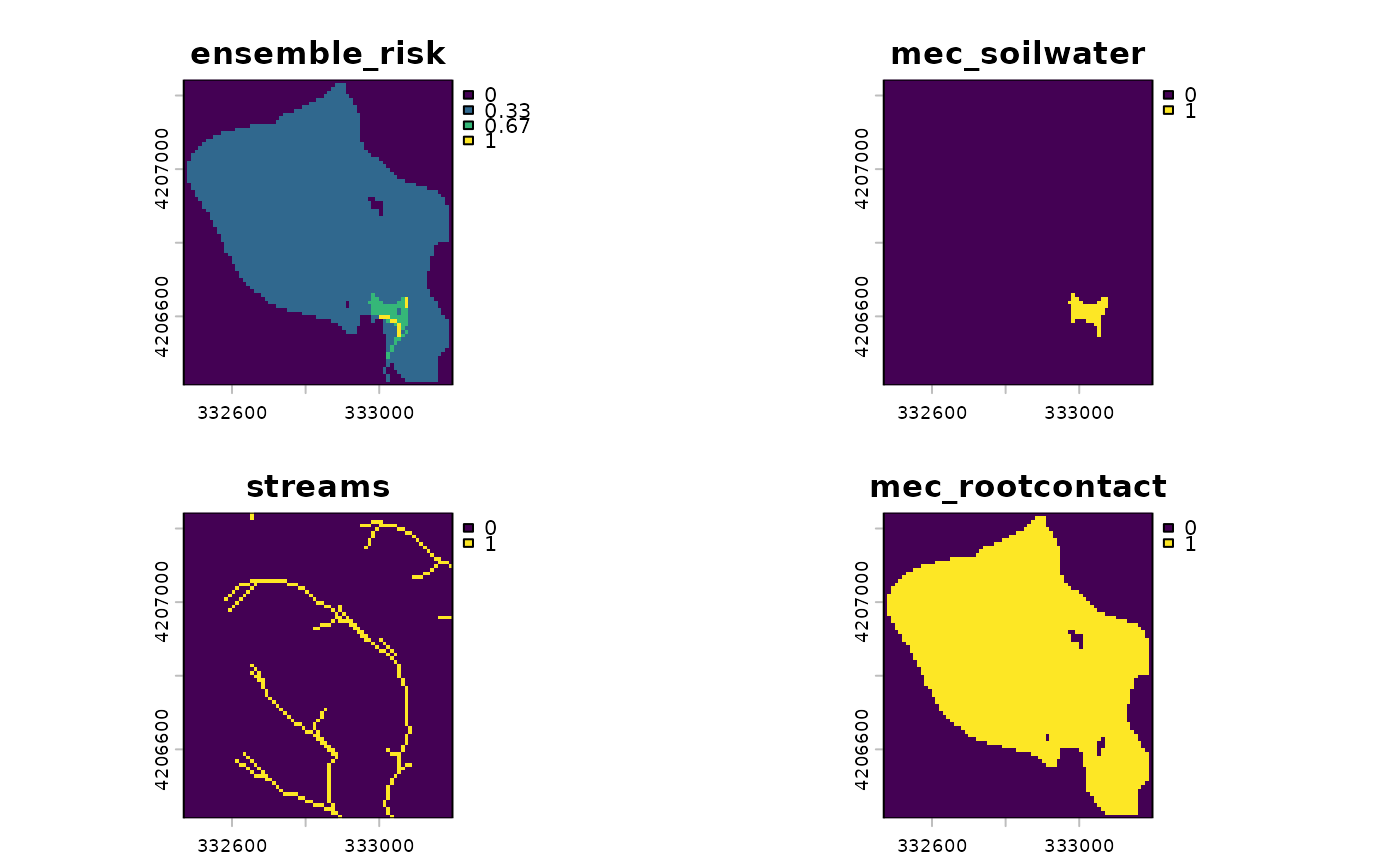
When append_mec = TRUE the individual mechanism rasters are
concatenated with the ensemble layer in the returned SpatRaster,
allowing inspection of each component alongside the final risk surface.
Examples
# \donttest{
## load packages
library(phytorisk)
library(sf)
library(terra)
## load data
poi_sf <- st_read(
system.file("spatial/poi.geojson", package = "phytorisk"),
quiet = TRUE
)
dem_sr <- rast(system.file("spatial/dem_light.tiff", package = "phytorisk"))
trees_sr <- rast(system.file("spatial/trees_light.tiff", package = "phytorisk"))
aoi_sf <- st_read(
system.file("spatial/tejera.geojson", package = "phytorisk"),
quiet = TRUE
)
## calculate ensemble risk, returning individual mechanisms
risk_equal_sr <- phytorisk_ensemble_raw(
aoi = aoi_sf,
poi = poi_sf,
dem = dem_sr,
treecover = trees_sr,
append_mec = TRUE
)
#>
#> ── Mec Ii - Spread in soil water ───────────────────────────────────────────────
#> ℹ Filling DEM...
#> ✔ DEM filled [17ms]
#>
#> ℹ Filling basins...
#> ✔ Basins filled [40ms]
#>
#> ℹ Removing depressions...
#> ✔ Depressions removed [29ms]
#>
#> ℹ Filling depressions...
#> ✔ Depressions filled [30ms]
#>
#> ℹ Getting flow directions...
#> ✔ Flow directions [30ms]
#>
#> ℹ Calculating flow accumulation...
#> ✔ Flow accumulation calculated [29ms]
#>
#> ℹ Delineating streams...
#> ✔ Streams delineated [23ms]
#>
#> ℹ Determining the wet front
#> ✔ Wet front determined [700ms]
#>
#>
#> ── Mec Iii - Root-to-root contact ──────────────────────────────────────────────
#> ℹ Preparing tree data...
#> ✔ Tree data prepared [63ms]
#>
#> ℹ Finding root-to-root contact...
#> ✔ Finished [13.4s]
#>
#>
#> ── Mec II - Spread in surface water ────────────────────────────────────────────
#> ℹ Calculating natural drainage network...
#> ✔ Natural drainage network calculated [39ms]
#>
#> ℹ Identifying surface water close to foci...
#> ✔ Surface water close to foci identified [54ms]
#>
#> ℹ Finding connected pixels...
#> ✔ Finished [821ms]
#>
## visualize results
plot(risk_equal_sr)
 # }
# }